Sensors, Telemetry & Monitoring
The activity consists of two types of monitoring regarding hydraulic conditions and biodiversity. Hydraulic conditions: installation of continuous level sensors in two watercourses (Pianton, Vernise); execution of flow measures campaigns. Biodiversity: birds, lepidoptera, odonates. Other activity: monitoring the presence of nutria (coypu) in order to assess how it is affected by the NBS. Meteorological data are also collected from Mogliano Veneto Station.
Monitoring system diagram
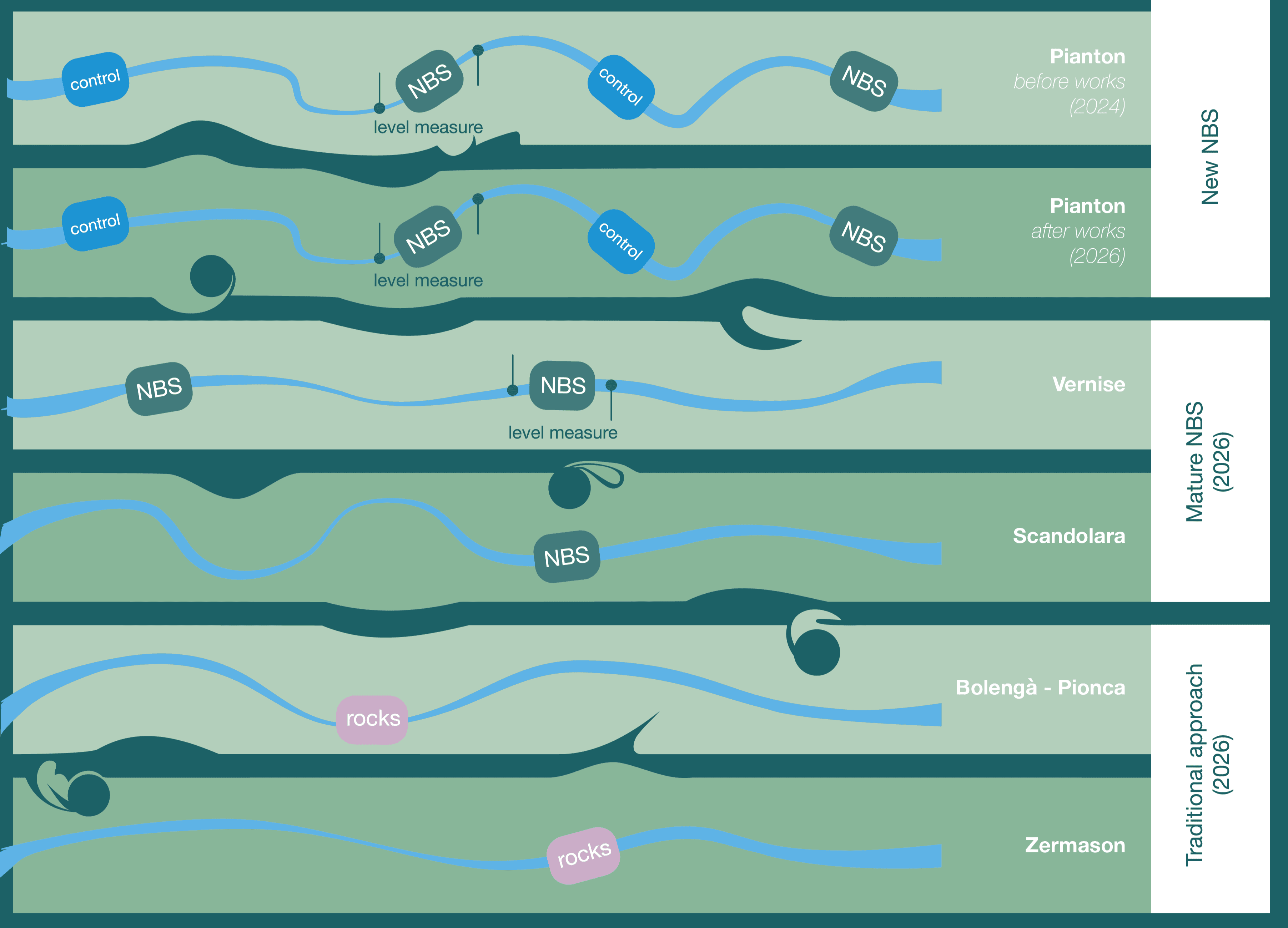
Monitoring schema - Slope Reduction & Vegetation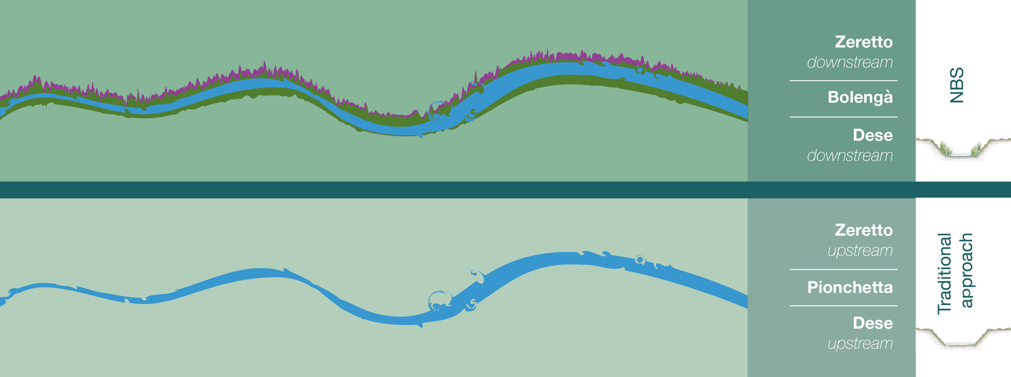
Monitoring schema - Riparian grass
Meteorological Data
Meteorological Conditions in Mogliano Veneto
24-hour meteorological observations (Mogliano Veneto Station (ARPAV))
Water Level Data (Slope reduction)
Two pairs of upstream and downstream level sensors were installed for the Pianton River (testing site) and the Vernise River (reference site for a mature stage of the NBS). Level time series inform in real time about the state of the watercourses and feed hydrodynamic models.
Pianton River water level
Last 72-Hour of Available Data
7 Nov 2026, 16:01 – 10 Nov 2026, 16:01
Water level fluctuations for Pianton River
Vernise River water level
Last 72-Hour of Available Data
7 Nov 2026, 16:01 – 10 Nov 2026, 16:01
Water level fluctuations for Vernise River
Biodiversity Monitoring (Slope reduction)
Biodiversity monitoring for Slope reduction and vegetation includes the assessment of abundance, diversity, and richness indicators for birds, odonates and lepidoptera, and the coverage of different plant typologies through an analysis of vegetation maps obtained by combining high-resolution aerial images with field observations.
Before works abundance of bird species in the four survey sites of Pianton (NBS2)
The survey detected 22 species in total (18 in reference sites and 12 in NBS2 sites). The community is composed of species of birds typical of agroecosystems. Nine species are linked to small watercourses and canals, three of which are dominant: the mallard, the moorhen, and the pygmy cormorant.
Abundance of Coypu burrows along the four sample transect (NBS2)
Visual monitoring of burrows is carried out to verify whether the NBS can help reduce settlement along the slope of the canal. The abundance of burrows before works is quite regular along three transects.
Biodiversity Monitoring (Riparian grass)
Biodiversity monitoring for Riparian Grass includes the assessment of abundance, diversity, and richness indicators for odonates and lepidoptera, and the coverage of different plant typologies through an analysis of vegetation maps obtained by combining high-resolution aerial images with field observations.
Surface area covered by type of vegetation along two sample transects (NBS1)
Monitoring of vegetation is carried out in 2 transects (400 m each) to verify whether the NBS can help improve biodiversity in the river. - In the upstream transect, the herbaceous vegetation is completely cut; - In the downstream transect, the herbaceous vegetation is cut only in the upper part of the bank.